Zoom
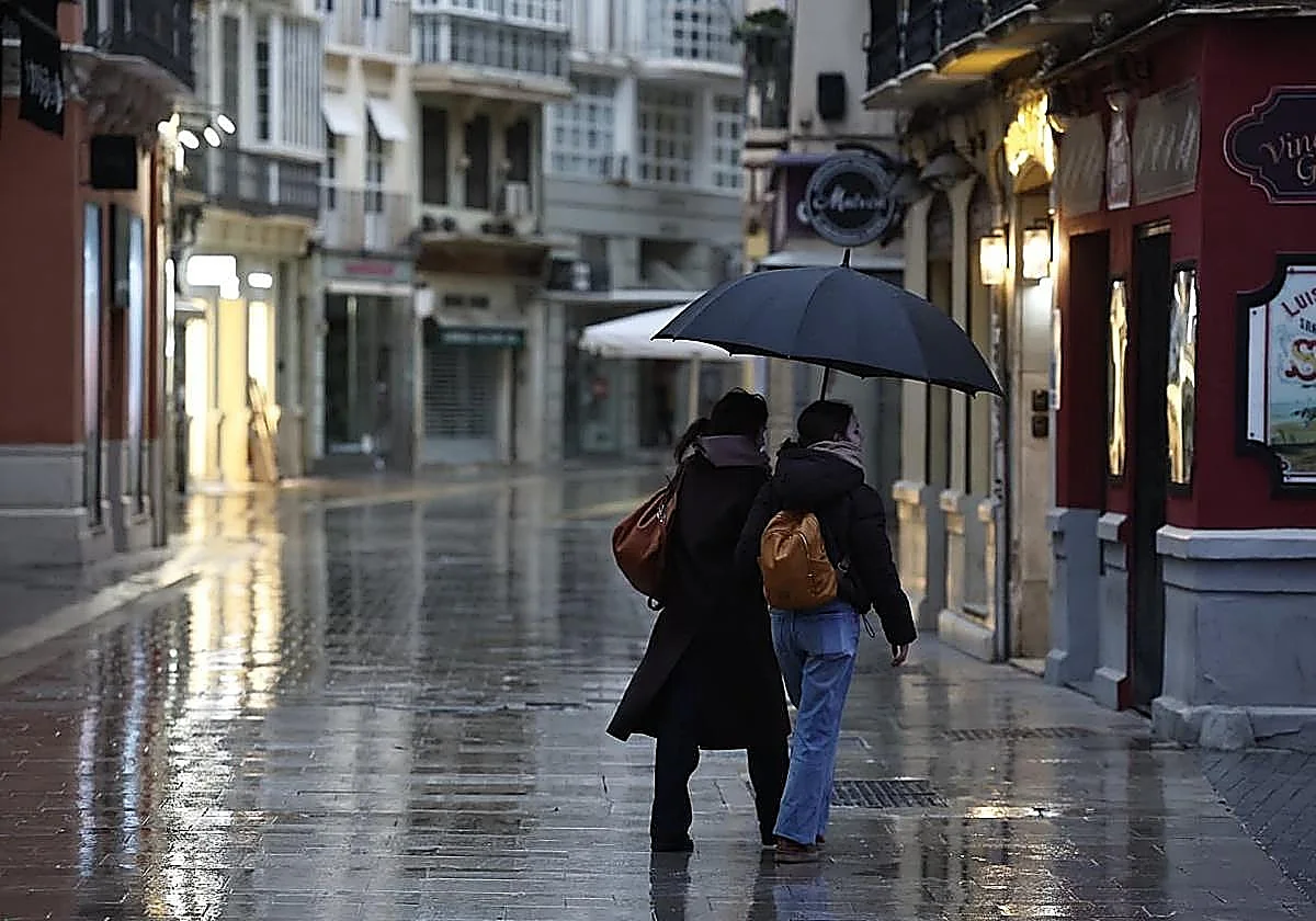
From this Wednesday onwards, the umbrellas will be out again across Malaga. SALVADOR SALAS Weather Stormy weather: Aemet forecasts rain across Malaga from today until SundayThe movement of successive storms across Europe from north to south will ensure significant rainfall for the Costa del Sol province throughout the rest of the week
Malaga
Wednesday, 21 January 2026, 12:48
The clouds that usually pass over northern Europe are currently moving south. A succession of storms and weather fronts are descending from the north, bringing rain that will be "not very heavy, but almost every day", says Jesús Riesco, director of Aemet (Spain's national weather agency). "Some days it will reach the coast less, but it will rain every day and in a large part of the province," he states.
According to this meteorologist, this is due to atmospheric circulation caused by the north-westerly flow across the Atlantic, from north to south: "Some of these are moving further down and affect us; the door has been opened to storms and they are rolling in one after another: in other years, we've been talking about drought at this time of year and yet this year we're above normal", says the Aemet boss.
As a result, rain returns to Malaga this Wednesday afternoon and will continue throughout the rest of the week, including the weekend.
The first of these storms already has a name: Harry. Today it is making its presence felt in the form of strong winds along the Axarquia coast, where Aemet has activated a yellow warning (low risk) for winds of up to 70 km/h (45mph) and for high waves (two to three metres). The alert remains active for tomorrow.
20
litres per square metre are expected in the westernmost part of the province this Wednesday.
The rain will arrive today, some time between afternoon and evening, and will begin to be felt in the western area at around 2:00pm and in Malaga city around 8:00-9:00pm. The European model calculates that there could be accumulations of up to 20 litres per square metre in the far west (on the border of the Serranía de Ronda with Cadiz province), 15 litres per square metre in Marbella and Estepona and between five and ten litres per square metre in the rest of the province, including the Axarquía area, which could also benefit.
José Luis Escudero, the weather forecaster and blogger from Malaga, explains that this situation is due to a powerful anticyclone located over Scandinavia. This is causing cloud masses to move closer to the Iberian peninsula, bringing rain to the province once again. "Thanks to this anticyclone, several fronts will cross our path in the coming days."
Storm Harry
Aemet also forecasts rain for most of the rest of the week in the province. The rain will start up again on Thursday afternoon. On Friday, it will rain practically all day long and it may continue on Saturday and Sunday, although the weekend is still a fair way off and we will have to keep an eye on developments over the next few days.
"According to the updated models, the first front is likely to reach Malaga province on Wednesday afternoon. Not much rainfall is expected, but whatever falls will be very welcome. Everything indicates that we will be subject to these storms until Friday, but we will see which areas are expected receive the most rainfall during these days. Hopefully the storms will continue until next weekend," adds Escudero.
Possible snowfall
Therefore, rain is pretty much a dead cert for the next three days and it is likely to continue over the weekend. As for temperatures, they will be generally mild and average for most of the rest of the week, with highs of 18C and lows of 10-12C. Saturday is the exception and will be the coldest day, with only a max of 13C expected in Malaga city.
Inland, the weather will be similar: daytime highs will be stable, around 12-13C, and nighttime lows between 3C and 7C. Except for Saturday, which will see highs of only 8C during the day (2C in the early morning). West and northwest winds will be keenly felt in the form of a winter terral (land wind) in the areas where this weather phenomenon usually occurs, such as the Guadalhorce Valley, Malaga city, Vélez-Málaga and Estepona. In these places, the cold inland wind will create an icy windchill.
There may still be a few more surprises in store for the Costa del Sol province. According to Aemet's director, the significant drop in temperature on Saturday, due to the arrival of a cold air mass, could once again cause the rainfall to turn into snow from mid-elevations upwards, around 900-1000 metres above sea level. On the other days, the snow level will be between 1300 and 1400 metres.