Zoom
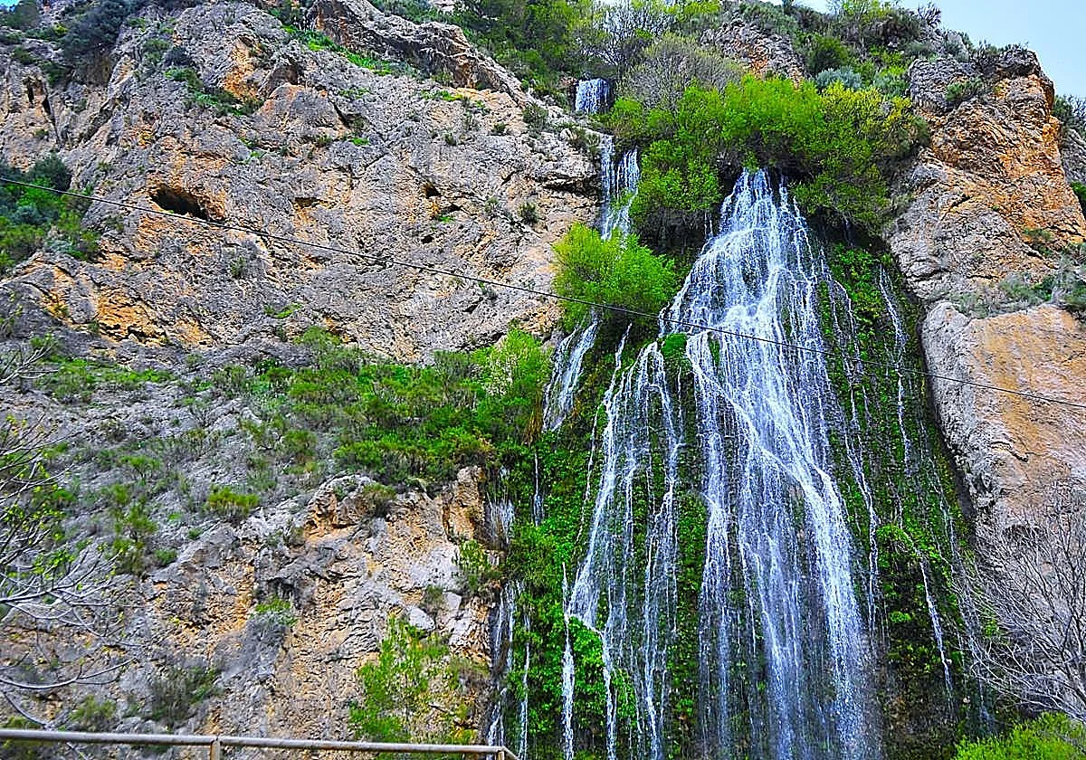
The gigantic Rio de la Toba Waterfall Rafael Vílchez Environment The giant waterfall in Granada province that tourists are flocking toThe immense cascade, which plunges down a gigantic cliff thanks to the recent heavy rains, is located in the municipality of Los Guájares
Rafael Vílchez
Wednesday, 11 March 2026, 16:10
The municipality of Los Guájares in Granada province is home to the enormous Río de la Toba waterfall. It is actually a man-made cascade, created in 1973 to manage the surplus water from an old irrigation ditch.
After the recent spells of heavy rainfall, the beauty spot has become one of the main tourist attractions of Los Guájares, which is made of up of Guájar Faragüit, Guájar Fondón and Guájar Alto. The water gushes down an imposing cliff into a valley characterised by its abrupt and steep surroundings, dotted with caves and a footpath.
During the 16th century, the course of the Río de la Toba was the scene of bloody episodes when the Marquis of Mondéjar troops advanced through the area.
Near the Los Guájares waterfall are historical remains such as El Castillejo, a 13th century fortress and the area of La Fuente Santa, linked to local legends. El Salto, as the Rio de la Toba waterfall is also called, is a point of scenic and hiking interest, often together with the Barranco del Rio de la Toba ravine, which is an important area for canyoning.
The Ruta de la Toba is nine kilometres long and goes up the Río de la Toba, passing through the three villages that make up Los Guájares. It starts at the entrance to Guájar Fondón, in Calle Molino, under the San Antonio de Padua church. It then descends to Las Cabezuelas, crosses the Río de la Toba, passes the football pitch and continues along the path that connects Guájar Fondón and Guájar Faragüit, passing the Mirador de la Cruz.
It then crosses Guájar Faragüit, via Calle Molineta and Calle Lepanto before continuing along an asphalted track to the Barranco del Arroyo ravine. After crossing the ravine the route passes along a path that runs through terraced fields and vegetable gardens.
The route reaches the road and goes down to the river until it reaches the Era del Tejar. On the other side of the river, the route continues along a path that leads to a ravine of ecological interest, passes an old irrigation channel and a field of almond trees before descending through the El Quemado area and ascends to the Collado de la Viñuela.
After about 700 metres it turns right and passes through a field until it reaches a path that enters a wood. It then passes through the Pinar del Barranco Morrón ravine and then climbs along a narrow path with views of Guájar Alto, until it comes out at a fork; on the right it reaches the Mirador de la Rebalosa viewpoint.
Amidst Mediterranean vegetation, the path descends the Barranco de la Fuente Santa ravine, crosses it and continues along a stony path that climbs to a dirt track. The track on the left ends in the lower part of Guájar Alto.